
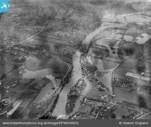
EPW049601 ENGLAND (1936). The River Thames at Sunbury Lock Ait and Walton-on-Thames, Walton-on-Thames, from the north-east, 1936
© Copyright OpenStreetMap contributors and licensed by the OpenStreetMap Foundation. 2026. Cartography is licensed as CC BY-SA.
Nearby Images (9)
EPW049601

EPW049563

EPW028312

EPW028313

EPW028311

EPW028317

EPW028318

EPW023469

EAW003681

Details
| Title | [EPW049601] The River Thames at Sunbury Lock Ait and Walton-on-Thames, Walton-on-Thames, from the north-east, 1936 |
| Reference | EPW049601 |
| Date | January-1936 |
| Link | |
| Place name | WALTON-ON-THAMES |
| Parish | |
| District | |
| Country | ENGLAND |
| Easting / Northing | 510637, 168289 |
| Longitude / Latitude | -0.40929901470863, 51.402331987737 |
| National Grid Reference | TQ106683 |
Pins
Be the first to add a comment to this image!