
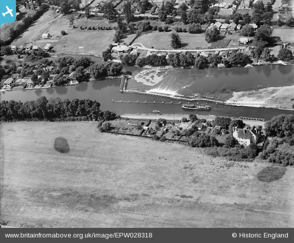
EPW028318 ENGLAND (1929). Sunbury Weir and environs, Sunbury-on-Thames, 1929
© Copyright OpenStreetMap contributors and licensed by the OpenStreetMap Foundation. 2026. Cartography is licensed as CC BY-SA.
Nearby Images (5)
EPW028318

EPW028311

EPW028313

EPW049563

EPW049601

Details
| Title | [EPW028318] Sunbury Weir and environs, Sunbury-on-Thames, 1929 |
| Reference | EPW028318 |
| Date | August-1929 |
| Link | |
| Place name | SUNBURY-ON-THAMES |
| Parish | |
| District | |
| Country | ENGLAND |
| Easting / Northing | 510493, 168132 |
| Longitude / Latitude | -0.41141744734034, 51.40094875944 |
| National Grid Reference | TQ105681 |
Pins

Hanworth1915 |
Wednesday 17th of January 2024 06:56:04 PM | |
|
Hanworth1915 |
Wednesday 17th of January 2024 06:53:56 PM | |
|
Hanworth1915 |
Wednesday 17th of January 2024 06:53:25 PM | |
|
Geoff L |
Saturday 25th of February 2023 04:19:45 PM | |
|
bumblee |
Sunday 23rd of October 2016 11:59:54 AM | |
|
bumblee |
Sunday 7th of September 2014 12:00:04 PM | |
|
bumblee |
Sunday 7th of September 2014 11:58:24 AM |