
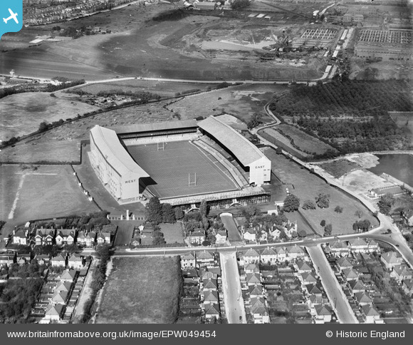
EPW049454 ENGLAND (1935). Twickenham Rugby Football Ground, Twickenham, 1935
© Copyright OpenStreetMap contributors and licensed by the OpenStreetMap Foundation. 2026. Cartography is licensed as CC BY-SA.
Nearby Images (22)
EPW049454

EPW025840

EPW049447

EPW025843

EPW022945

EPW049455

EPW025839

EPW025841

EPW025842

EPW049453

EPR000638

EPW023249

EPW025845

EPW025844

EPW049446

EPW017385

EPW049452

EPW049450

EPW049449

EPW049451

EPW049448

EPW034843

Details
| Title | [EPW049454] Twickenham Rugby Football Ground, Twickenham, 1935 |
| Reference | EPW049454 |
| Date | October-1935 |
| Link | |
| Place name | TWICKENHAM |
| Parish | |
| District | |
| Country | ENGLAND |
| Easting / Northing | 515348, 174326 |
| Longitude / Latitude | -0.33962955309192, 51.45565897139 |
| National Grid Reference | TQ153743 |
Pins

Martin Devlin |
Friday 9th of February 2024 10:35:40 PM |