
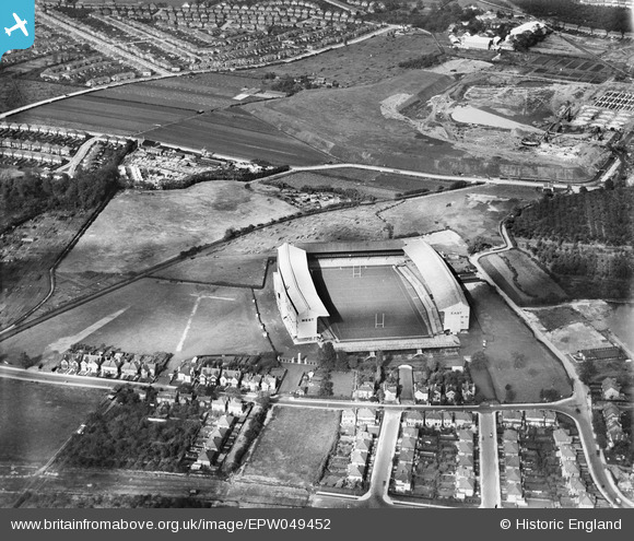
EPW049452 ENGLAND (1935). Twickenham Rugby Football Ground, Twickenham, 1935
© Copyright OpenStreetMap contributors and licensed by the OpenStreetMap Foundation. 2026. Cartography is licensed as CC BY-SA.
Nearby Images (22)
EPW049452

EPW049446

EPR000638

EPW025841

EPW022945

EPW025843

EPW049449

EPW049453

EPW025840

EPW025839

EPW049455

EPW025845

EPW049454

EPW049447

EPW023249

EPW025842

EPW034843

EPW049451

EPW025844

EPW049450

EPW017385

EPW049448

Details
| Title | [EPW049452] Twickenham Rugby Football Ground, Twickenham, 1935 |
| Reference | EPW049452 |
| Date | October-1935 |
| Link | |
| Place name | TWICKENHAM |
| Parish | |
| District | |
| Country | ENGLAND |
| Easting / Northing | 515260, 174354 |
| Longitude / Latitude | -0.34088656646239, 51.455928584503 |
| National Grid Reference | TQ153744 |
Pins

Anno |
Monday 1st of February 2016 07:12:10 PM | |
|
The Blue Max |
Sunday 3rd of May 2015 12:05:21 PM |