
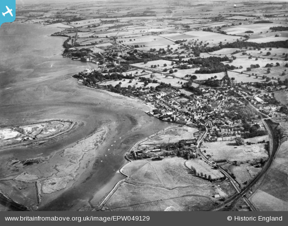
EPW049129 ENGLAND (1935). The town and environs, Manningtree, 1935. This image has been produced from a copy-negative.
© Copyright OpenStreetMap contributors and licensed by the OpenStreetMap Foundation. 2026. Cartography is licensed as CC BY-SA.
Nearby Images (16)
EPW049129

EAW043684

EAW031070

EAW031065

EAW031072

EAW043683

EAW031069

EAW031068

EAW031073

EAW031064

EAW031066

EAW031067

EAW031071

EAW043682

EAW043685

EPW018544

Details
| Title | [EPW049129] The town and environs, Manningtree, 1935. This image has been produced from a copy-negative. |
| Reference | EPW049129 |
| Date | August-1935 |
| Link | |
| Place name | MANNINGTREE |
| Parish | MANNINGTREE |
| District | |
| Country | ENGLAND |
| Easting / Northing | 610831, 231944 |
| Longitude / Latitude | 1.0680007412902, 51.945542610541 |
| National Grid Reference | TM108319 |
Pins
Be the first to add a comment to this image!