
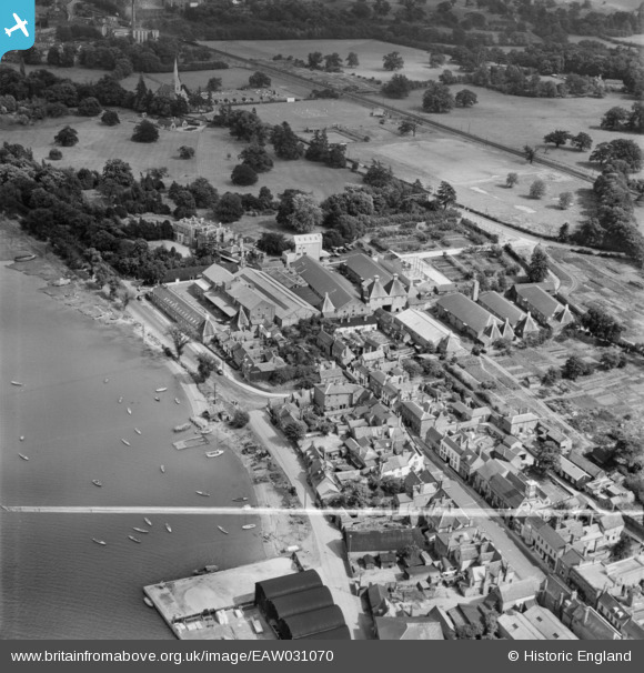
EAW031070 ENGLAND (1950). The Dalgety Maltings and the High Street, Manningtree, 1950. This image was marked by Aerofilms Ltd for photo editing.
© Copyright OpenStreetMap contributors and licensed by the OpenStreetMap Foundation. 2026. Cartography is licensed as CC BY-SA.
Nearby Images (15)
EAW031070

EAW031072

EAW031065

EAW031069

EAW031073

EAW031064

EAW031066

EAW031068

EAW043684

EAW031067

EPW049129

EAW043683

EAW031071

EAW043682

EAW043685

Details
| Title | [EAW031070] The Dalgety Maltings and the High Street, Manningtree, 1950. This image was marked by Aerofilms Ltd for photo editing. |
| Reference | EAW031070 |
| Date | 19-July-1950 |
| Link | |
| Place name | MANNINGTREE |
| Parish | MANNINGTREE |
| District | |
| Country | ENGLAND |
| Easting / Northing | 610889, 231863 |
| Longitude / Latitude | 1.0687937638567, 51.944793336081 |
| National Grid Reference | TM109319 |
Pins
Be the first to add a comment to this image!