
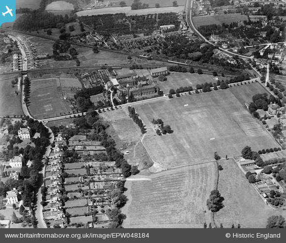
EPW048184 ENGLAND (1935). Dean Close Memorial School and environs, Cheltenham, 1935
© Copyright OpenStreetMap contributors and licensed by the OpenStreetMap Foundation. 2026. Cartography is licensed as CC BY-SA.
Nearby Images (13)
EPW048184

EPW048185

EPW048183

EPW048188

EPW048182

EPW048187

EPW048186

EPR000394

EPW048189

EPW024133

EPW000172

EPW000176

EPW048200

Details
| Title | [EPW048184] Dean Close Memorial School and environs, Cheltenham, 1935 |
| Reference | EPW048184 |
| Date | July-1935 |
| Link | |
| Place name | CHELTENHAM |
| Parish | |
| District | |
| Country | ENGLAND |
| Easting / Northing | 392993, 221554 |
| Longitude / Latitude | -2.1018327243519, 51.89205648312 |
| National Grid Reference | SO930216 |
Pins
Be the first to add a comment to this image!