
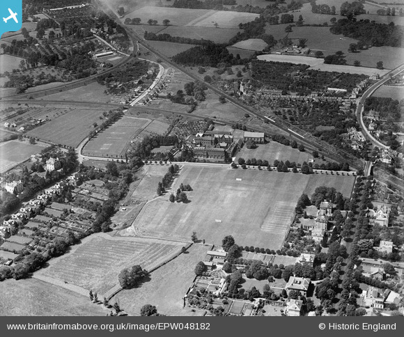
EPW048182 ENGLAND (1935). Dean Close Memorial School and environs, Cheltenham, 1935
© Copyright OpenStreetMap contributors and licensed by the OpenStreetMap Foundation. 2026. Cartography is licensed as CC BY-SA.
Nearby Images (13)
EPW048182

EPW048187

EPW048186

EPW048189

EPW048183

EPR000394

EPW024133

EPW000172

EPW048184

EPW048188

EPW000176

EPW048185

EPW048200

Details
| Title | [EPW048182] Dean Close Memorial School and environs, Cheltenham, 1935 |
| Reference | EPW048182 |
| Date | July-1935 |
| Link | |
| Place name | CHELTENHAM |
| Parish | |
| District | |
| Country | ENGLAND |
| Easting / Northing | 392928, 221569 |
| Longitude / Latitude | -2.102777675347, 51.892190540321 |
| National Grid Reference | SO929216 |
Pins

Eric Williams |
Saturday 10th of April 2021 01:24:18 PM | |
|
drjameslambert |
Friday 2nd of May 2014 03:19:24 PM |