
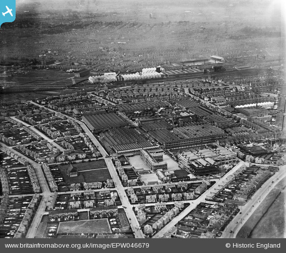
EPW046679 ENGLAND (1935). The Rolls-Royce Works and environs, Derby, from the south-east, 1935
© Copyright OpenStreetMap contributors and licensed by the OpenStreetMap Foundation. 2026. Cartography is licensed as CC BY-SA.
Nearby Images (14)
EPW046679

EPW046674

EAW013107

EPW046672

EAW013109

EAW013112

EPW046673

EPW046675

EAW013117

EAW013108

EPW046678

EPW046676

EAW013119

EPW046677

Details
| Title | [EPW046679] The Rolls-Royce Works and environs, Derby, from the south-east, 1935 |
| Reference | EPW046679 |
| Date | March-1935 |
| Link | |
| Place name | DERBY |
| Parish | |
| District | |
| Country | ENGLAND |
| Easting / Northing | 436440, 333363 |
| Longitude / Latitude | -1.4582583200104, 52.896155451382 |
| National Grid Reference | SK364334 |
Pins

KhalSir |
Tuesday 10th of November 2015 07:13:17 PM | |
|
KhalSir |
Tuesday 10th of November 2015 07:12:37 PM | |
|
KhalSir |
Tuesday 10th of November 2015 07:12:07 PM | |
|
Triggy |
Monday 4th of May 2015 08:55:43 PM | |
|
Triggy |
Sunday 9th of February 2014 08:49:17 PM |