
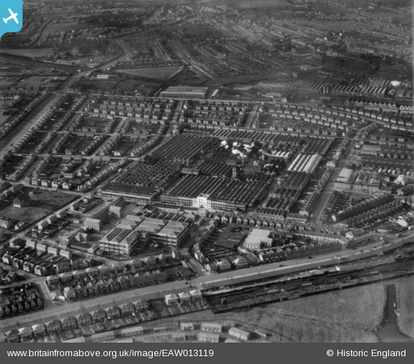
EAW013119 ENGLAND (1948). The Rolls Royce Nightingale Road Works and environs, Osmaston, 1948
© Copyright OpenStreetMap contributors and licensed by the OpenStreetMap Foundation. 2026. Cartography is licensed as CC BY-SA.
Nearby Images (15)
EAW013119

EPW046677

EPW046678

EAW013114

EAW013116

EAW013113

EAW013111

EPW046673

EPW046672

EAW044384

EAW013112

EAW013109

EPW046674

EPW046675

EPW046679

Details
| Title | [EAW013119] The Rolls Royce Nightingale Road Works and environs, Osmaston, 1948 |
| Reference | EAW013119 |
| Date | 4-February-1948 |
| Link | |
| Place name | OSMASTON |
| Parish | |
| District | |
| Country | ENGLAND |
| Easting / Northing | 436291, 333591 |
| Longitude / Latitude | -1.4604478901018, 52.898215246305 |
| National Grid Reference | SK363336 |
Pins
Be the first to add a comment to this image!