
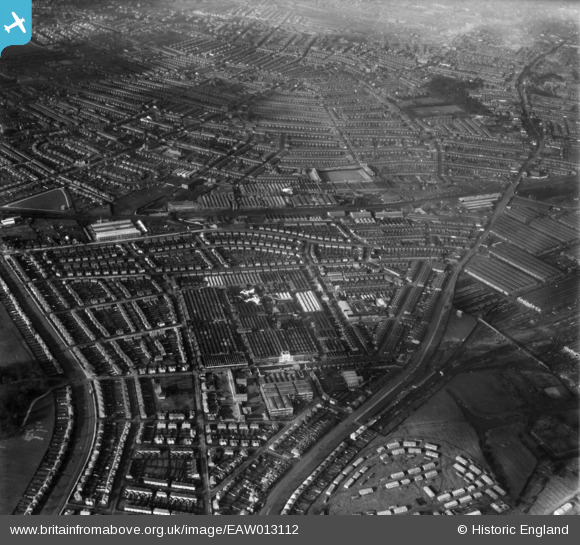
EAW013112 ENGLAND (1948). The Rolls Royce Nightingale Road Works and surrounding residential districts, Osmaston, from the south-east, 1948
© Copyright OpenStreetMap contributors and licensed by the OpenStreetMap Foundation. 2026. Cartography is licensed as CC BY-SA.
Nearby Images (15)
EAW013112

EPW046674

EPW046672

EPW046679

EPW046675

EAW013109

EPW046673

EAW013107

EAW013108

EPW046678

EPW046676

EAW013114

EAW013119

EPW046677

EAW013117

Details
| Title | [EAW013112] The Rolls Royce Nightingale Road Works and surrounding residential districts, Osmaston, from the south-east, 1948 |
| Reference | EAW013112 |
| Date | 4-February-1948 |
| Link | |
| Place name | OSMASTON |
| Parish | |
| District | |
| Country | ENGLAND |
| Easting / Northing | 436451, 333457 |
| Longitude / Latitude | -1.458084253126, 52.896999762883 |
| National Grid Reference | SK365335 |
Pins

Al |
Thursday 19th of October 2017 12:25:29 AM | |
|
Al |
Thursday 19th of October 2017 12:25:04 AM | |

Sparky |
Wednesday 26th of July 2017 12:30:37 PM | |
|
Triggy |
Wednesday 3rd of February 2016 10:27:14 PM | |
|
Triggy |
Wednesday 3rd of February 2016 10:26:02 PM | |
|
Triggy |
Wednesday 3rd of February 2016 10:25:07 PM | |
|
Triggy |
Wednesday 3rd of February 2016 10:24:01 PM | |
|
Triggy |
Wednesday 3rd of February 2016 10:23:22 PM |