
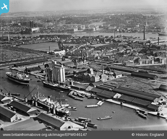
EPW046147 ENGLAND (1934). Millwall Docks, Cubitt Town and environs, Isle of Dogs, from the north-west, 1934
© Copyright OpenStreetMap contributors and licensed by the OpenStreetMap Foundation. 2026. Cartography is licensed as CC BY-SA.
Nearby Images (18)
EPW046147

EPW046146

EAW011757

EAW011755

EPW060548

EAW011759

EPW046145

EAW011753

EAW011752

EAW011754

EPW044130

EAW011756

EPW044131

EPW046149

EPW046148

EAW011758

EPW060455

EAW009803

Details
| Title | [EPW046147] Millwall Docks, Cubitt Town and environs, Isle of Dogs, from the north-west, 1934 |
| Reference | EPW046147 |
| Date | September-1934 |
| Link | |
| Place name | ISLE OF DOGS |
| Parish | |
| District | |
| Country | ENGLAND |
| Easting / Northing | 537549, 178987 |
| Longitude / Latitude | -0.018432403185631, 51.49258899517 |
| National Grid Reference | TQ375790 |
Pins

bushwhackers |
Thursday 27th of October 2016 08:10:40 PM | |
|
moses72 |
Wednesday 28th of August 2013 07:45:05 PM |