
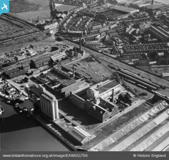
EAW011756 ENGLAND (1947). McDougalls Limited Wheatsheaf Flour Mills, Millwall, 1947
© Copyright OpenStreetMap contributors and licensed by the OpenStreetMap Foundation. 2026. Cartography is licensed as CC BY-SA.
Nearby Images (17)
EAW011756

EAW011758

EAW011752

EAW011755

EAW011753

EPW046149

EPW060548

EPW046147

EPW046146

EAW011759

EAW011757

EPW046148

EAW011754

EPW060455

EPW044130

EPW046145

EAW021719

Details
| Title | [EAW011756] McDougalls Limited Wheatsheaf Flour Mills, Millwall, 1947 |
| Reference | EAW011756 |
| Date | 9-October-1947 |
| Link | |
| Place name | MILLWALL |
| Parish | |
| District | |
| Country | ENGLAND |
| Easting / Northing | 537575, 178857 |
| Longitude / Latitude | -0.018108761904018, 51.491414340718 |
| National Grid Reference | TQ376789 |
Pins
Be the first to add a comment to this image!