
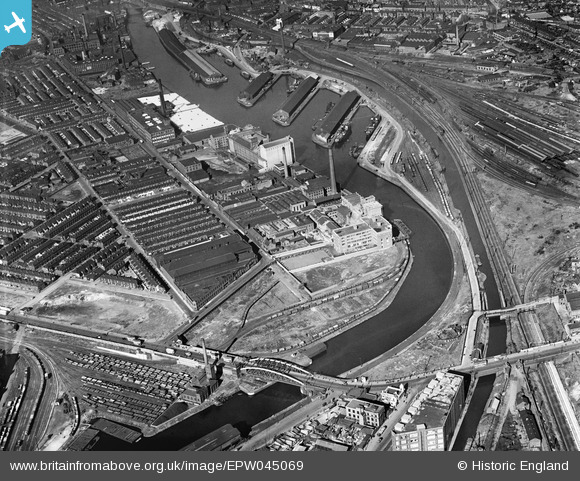
EPW045069 ENGLAND (1934). The Trafford Road Bridge and industrial works alongside the Pomona Docks, Ordsall, 1934
© Copyright OpenStreetMap contributors and licensed by the OpenStreetMap Foundation. 2026. Cartography is licensed as CC BY-SA.
Nearby Images (24)
EPW045069

EPW045065

EPW045070

EPW045992

EPW045066

EPW045071

EPW045067

EPW016773

EPW016777

EPW016772

EPW016774

EPW016775

EPW045068

EPW016771

EPW016776

EPW016770

EPW045983

EPW008985

EAW050415

EPW008988

EPW008989

EPW008990

EPW008991

EPW008987

Details
| Title | [EPW045069] The Trafford Road Bridge and industrial works alongside the Pomona Docks, Ordsall, 1934 |
| Reference | EPW045069 |
| Date | June-1934 |
| Link | |
| Place name | ORDSALL |
| Parish | |
| District | |
| Country | ENGLAND |
| Easting / Northing | 381497, 396666 |
| Longitude / Latitude | -2.2787484307125, 53.466155906882 |
| National Grid Reference | SJ815967 |
Pins

Dave |
Wednesday 16th of April 2014 12:36:52 PM |