
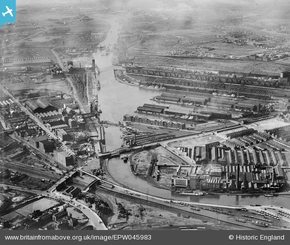
EPW045983 ENGLAND (1934). Salford Docks, Salford, from the south-east, 1934
© Copyright OpenStreetMap contributors and licensed by the OpenStreetMap Foundation. 2026. Cartography is licensed as CC BY-SA.
Nearby Images (11)
EPW045983

EPW045066

EPW045071

EPW045992

EPW045070

EPW045065

EPW045069

EPW045067

EPW016773

EPW016772

EPW016777

Details
| Title | [EPW045983] Salford Docks, Salford, from the south-east, 1934 |
| Reference | EPW045983 |
| Date | September-1934 |
| Link | |
| Place name | SALFORD |
| Parish | |
| District | |
| Country | ENGLAND |
| Easting / Northing | 381327, 396586 |
| Longitude / Latitude | -2.2813046993074, 53.465430753102 |
| National Grid Reference | SJ813966 |
Pins
 |

Barrie Price |
Thursday 15th of July 2021 12:39:41 PM |
|
phloberts |
Sunday 20th of January 2019 10:31:20 PM |