
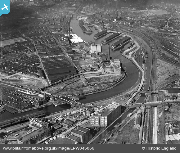
EPW045066 ENGLAND (1934). The Trafford Road Bridge and industrial works alongside the Pomona Docks, Ordsall, 1934
© Copyright OpenStreetMap contributors and licensed by the OpenStreetMap Foundation. 2026. Cartography is licensed as CC BY-SA.
Nearby Images (18)
EPW045066

EPW045070

EPW045065

EPW045069

EPW045992

EPW045071

EPW045067

EPW016773

EPW016772

EPW016777

EPW016774

EPW016775

EPW016771

EPW045983

EPW045068

EPW016776

EPW016770

EPW008985

Details
| Title | [EPW045066] The Trafford Road Bridge and industrial works alongside the Pomona Docks, Ordsall, 1934 |
| Reference | EPW045066 |
| Date | June-1934 |
| Link | |
| Place name | ORDSALL |
| Parish | |
| District | |
| Country | ENGLAND |
| Easting / Northing | 381465, 396653 |
| Longitude / Latitude | -2.2792297388061, 53.466037919123 |
| National Grid Reference | SJ815967 |
Pins
Be the first to add a comment to this image!