
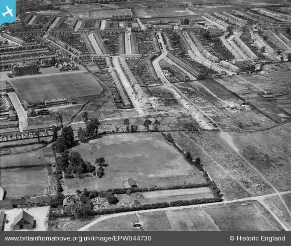
EPW044730 ENGLAND (1934). Woodlands Road, St Mary's Road and environs, Jubilee Park, from the south-east, 1934
© Copyright OpenStreetMap contributors and licensed by the OpenStreetMap Foundation. 2025. Cartography is licensed as CC BY-SA.
Nearby Images (10)
EPW044730

EPW044725

EPW044728

EPW044717

EPW044310

EPW044311

EPW044727

EPW044313

EPW044729

EPW044312

Details
| Title | [EPW044730] Woodlands Road, St Mary's Road and environs, Jubilee Park, from the south-east, 1934 |
| Reference | EPW044730 |
| Date | June-1934 |
| Link | |
| Place name | JUBILEE PARK |
| Parish | |
| District | |
| Country | ENGLAND |
| Easting / Northing | 535358, 194246 |
| Longitude / Latitude | -0.044100212710376, 51.630253310826 |
| National Grid Reference | TQ354942 |
Pins

Icos |
Tuesday 24th of June 2025 03:16:24 AM | |
 |
Icos |
Tuesday 20th of May 2025 11:09:17 AM |
 |
Icos |
Tuesday 20th of May 2025 11:08:55 AM |