
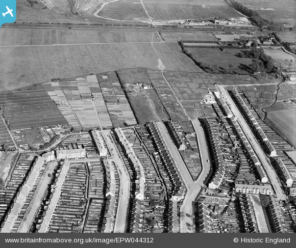
EPW044312 ENGLAND (1934). St Mary's Gardens and environs, Lower Edmonton, 1934
© Copyright OpenStreetMap contributors and licensed by the OpenStreetMap Foundation. 2025. Cartography is licensed as CC BY-SA.
Nearby Images (10)
EPW044312

EPW044313

EPW044311

EPW044310

EPW044727

EPW044729

EPW044728

EPW044725

EPW044730

EPW044717

Details
| Title | [EPW044312] St Mary's Gardens and environs, Lower Edmonton, 1934 |
| Reference | EPW044312 |
| Date | May-1934 |
| Link | |
| Place name | LOWER EDMONTON |
| Parish | |
| District | |
| Country | ENGLAND |
| Easting / Northing | 535256, 194400 |
| Longitude / Latitude | -0.045513670480584, 51.631661853936 |
| National Grid Reference | TQ353944 |
Pins

john ruscoe |
Saturday 2nd of November 2013 04:51:07 AM | |
|
john ruscoe |
Saturday 2nd of November 2013 04:50:28 AM |