
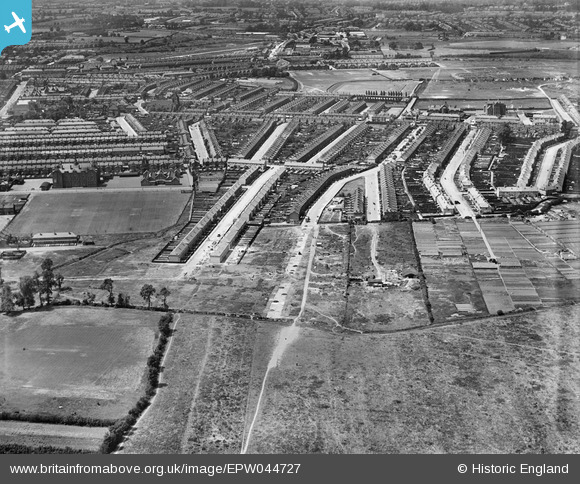
EPW044727 ENGLAND (1934). Woodlands Road, St Mary's Road and environs, Jubilee Park, 1934
© Copyright OpenStreetMap contributors and licensed by the OpenStreetMap Foundation. 2025. Cartography is licensed as CC BY-SA.
Nearby Images (10)
EPW044727

EPW044311

EPW044310

EPW044729

EPW044313

EPW044312

EPW044728

EPW044725

EPW044730

EPW044717

Details
| Title | [EPW044727] Woodlands Road, St Mary's Road and environs, Jubilee Park, 1934 |
| Reference | EPW044727 |
| Date | June-1934 |
| Link | |
| Place name | JUBILEE PARK |
| Parish | |
| District | |
| Country | ENGLAND |
| Easting / Northing | 535240, 194318 |
| Longitude / Latitude | -0.04577640909074, 51.630928761233 |
| National Grid Reference | TQ352943 |
Pins

asturgess |
Thursday 27th of February 2014 08:18:04 PM | |
|
asturgess |
Thursday 27th of February 2014 08:17:05 PM | |
|
asturgess |
Thursday 27th of February 2014 08:16:28 PM | |
|
john ruscoe |
Saturday 2nd of November 2013 04:27:50 AM | |
|
john ruscoe |
Saturday 2nd of November 2013 04:27:12 AM | |
|
john ruscoe |
Saturday 2nd of November 2013 04:25:38 AM | |
|
john ruscoe |
Saturday 2nd of November 2013 04:24:39 AM | |
|
john ruscoe |
Saturday 2nd of November 2013 04:22:06 AM | |
|
john ruscoe |
Saturday 2nd of November 2013 04:11:29 AM | |
|
john ruscoe |
Saturday 2nd of November 2013 04:06:14 AM |