
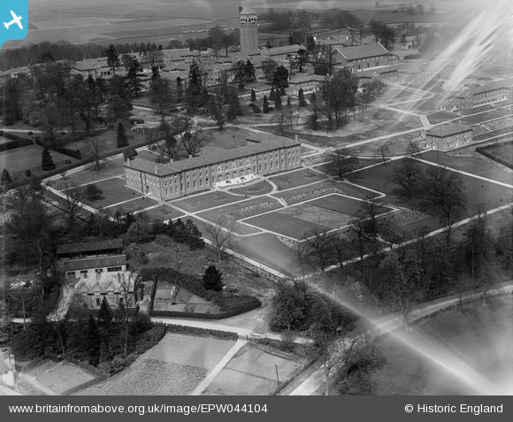
EPW044104 ENGLAND (1934). The Shenley Psychiatric Hospital, Shenley, 1934. This image has been affected by flare.
© Copyright OpenStreetMap contributors and licensed by the OpenStreetMap Foundation. 2026. Cartography is licensed as CC BY-SA.
Nearby Images (35)
EPW044104

EPW044101

EPW043669

EPW043674

EAW019113

EPW043666

EPW044102

EPW043673

EAW019111

EAW018909

EAW018910

EPW044111

EPW044109

EPW043668

EPW043672

EPW043677

EPW044107

EAW018900

EPW043680

EPW043665

EPW044105

EPW043670

EPW015745

EPW044108

EAW018901

EPW043664

EAW018904

EAW018908
, Shenley, from the south-east, 1948. This image has been produced from a damaged negative.")
EAW019112

EPW049672

EAW019110

EPW043667

EAW018902

EAW019115

EPW044103

Details
| Title | [EPW044104] The Shenley Psychiatric Hospital, Shenley, 1934. This image has been affected by flare. |
| Reference | EPW044104 |
| Date | April-1934 |
| Link | |
| Place name | SHENLEY |
| Parish | SHENLEY |
| District | |
| Country | ENGLAND |
| Easting / Northing | 518159, 200625 |
| Longitude / Latitude | -0.29033814220082, 51.691465294187 |
| National Grid Reference | TL182006 |
Pins
Be the first to add a comment to this image!