
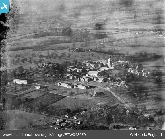
EPW043679 ENGLAND (1933). Shenley Mental Hospital and environs, Shenley, 1933. This image has been produced from a damaged negative.
© Copyright OpenStreetMap contributors and licensed by the OpenStreetMap Foundation. 2026. Cartography is licensed as CC BY-SA.
Nearby Images (22)
EPW043679

EPW044112

EPW049672

EPW043675

EAW018902

EPW044106

EAW018903

EPW015745

EAW018901

EAW018900

EPW044108

EAW018906

EPW043671

EAW018905

EPW044105

EAW018910

EAW018907

EAW019111

EPW044111

EPW044109

EPW044107

EAW018909

Details
| Title | [EPW043679] Shenley Mental Hospital and environs, Shenley, 1933. This image has been produced from a damaged negative. |
| Reference | EPW043679 |
| Date | December-1933 |
| Link | |
| Place name | SHENLEY |
| Parish | SHENLEY |
| District | |
| Country | ENGLAND |
| Easting / Northing | 518044, 200935 |
| Longitude / Latitude | -0.2918963877165, 51.69427583733 |
| National Grid Reference | TL180009 |
Pins
Be the first to add a comment to this image!