
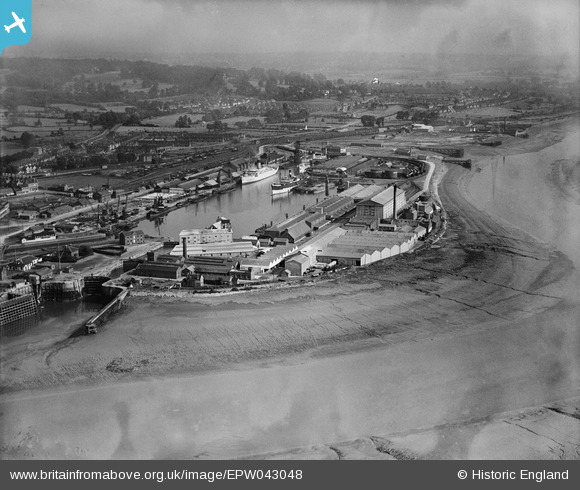
EPW043048 ENGLAND (1933). Avonmouth Dock, Avonmouth, from the north-west, 1933
© Copyright OpenStreetMap contributors and licensed by the OpenStreetMap Foundation. 2026. Cartography is licensed as CC BY-SA.
Nearby Images (12)
EPW043048

EPW043045

EPW043049

EPW043046

EPW008651

EPW043047

EPW005517

EPW027948

EPW043044

EPW005488

EPW005513

EPW014691

Details
| Title | [EPW043048] Avonmouth Dock, Avonmouth, from the north-west, 1933 |
| Reference | EPW043048 |
| Date | September-1933 |
| Link | |
| Place name | AVONMOUTH |
| Parish | |
| District | |
| Country | ENGLAND |
| Easting / Northing | 350844, 178026 |
| Longitude / Latitude | -2.708219251482, 51.498549762224 |
| National Grid Reference | ST508780 |
Pins

MB |
Saturday 20th of August 2016 04:50:53 PM | |
|
MB |
Saturday 20th of August 2016 04:50:32 PM | |
|
MB |
Saturday 20th of August 2016 04:43:59 PM |