
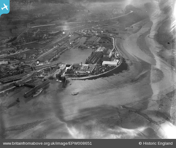
EPW008651 ENGLAND (1923). The Avonmouth Dock, Avonmouth, 1923
© Copyright OpenStreetMap contributors and licensed by the OpenStreetMap Foundation. 2026. Cartography is licensed as CC BY-SA.
Nearby Images (17)
EPW008651

EPW043044

EPW005488

EPW043049

EPW043046

EPW043048

EPW005517

EPW043045

EPW014691

EPW043047

EPW043043

EPW046970

EPW005513

EAW002071

EPW005487

EPW027948

EPW008649

Details
| Title | [EPW008651] The Avonmouth Dock, Avonmouth, 1923 |
| Reference | EPW008651 |
| Date | 1923 |
| Link | |
| Place name | AVONMOUTH |
| Parish | |
| District | |
| Country | ENGLAND |
| Easting / Northing | 350972, 178031 |
| Longitude / Latitude | -2.7063759265606, 51.498605841096 |
| National Grid Reference | ST510780 |
Pins
Be the first to add a comment to this image!