
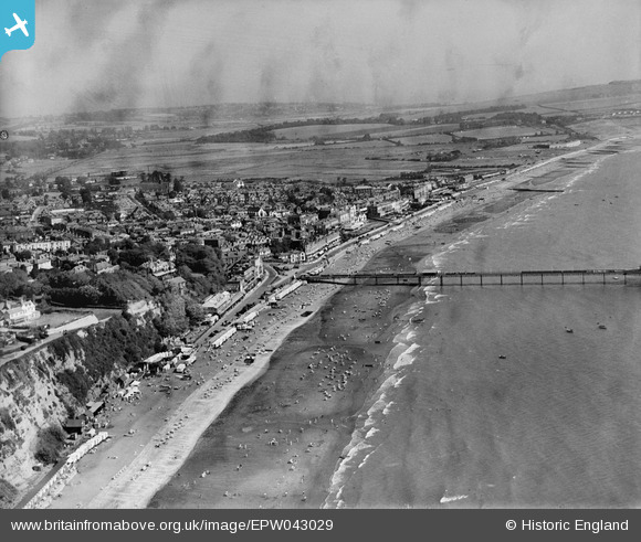
EPW043029 ENGLAND (1933). The seafront and town, Sandown, from the south, 1933
© Copyright OpenStreetMap contributors and licensed by the OpenStreetMap Foundation. 2026. Cartography is licensed as CC BY-SA.
Nearby Images (15)
EPW043029

EAW022216

EPW039671

EAW038580

EAW038583

EAW038582

EPW023084

EPW023085

EPW023083

EAW022215

EPW039672

EPW043028

EAW022219

EPW023080

EPW039670

Details
| Title | [EPW043029] The seafront and town, Sandown, from the south, 1933 |
| Reference | EPW043029 |
| Date | August-1933 |
| Link | |
| Place name | SANDOWN |
| Parish | SANDOWN |
| District | |
| Country | ENGLAND |
| Easting / Northing | 459739, 83844 |
| Longitude / Latitude | -1.154891611138, 50.650629971245 |
| National Grid Reference | SZ597838 |
Pins

HALLY64 |
Thursday 8th of August 2013 03:53:45 PM |