
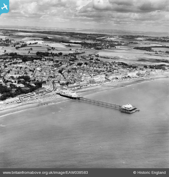
EAW038583 ENGLAND (1951). Sandown Pier and the town, Sandown, from the south, 1951. This image has been produced from a print.
© Copyright OpenStreetMap contributors and licensed by the OpenStreetMap Foundation. 2026. Cartography is licensed as CC BY-SA.
Nearby Images (16)
EAW038583

EAW038580

EPW023084

EAW038582

EAW022215

EPW023080

EPW039672

EPW043029

EPW039671

EAW022216

EPW023085

EPW043023

EPW023083

EAW022219

EPW043028

EPW039670

Details
| Title | [EAW038583] Sandown Pier and the town, Sandown, from the south, 1951. This image has been produced from a print. |
| Reference | EAW038583 |
| Date | 13-August-1951 |
| Link | |
| Place name | SANDOWN |
| Parish | SANDOWN |
| District | |
| Country | ENGLAND |
| Easting / Northing | 459855, 83875 |
| Longitude / Latitude | -1.1532457757452, 50.650896838233 |
| National Grid Reference | SZ599839 |
Pins
Be the first to add a comment to this image!