
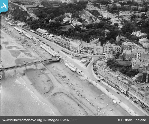
EPW023085 ENGLAND (1928). The Esplanade and Band Stand, Sandown, 1928
© Copyright OpenStreetMap contributors and licensed by the OpenStreetMap Foundation. 2026. Cartography is licensed as CC BY-SA.
Nearby Images (17)
EPW023085

EPW023083

EAW022219

EPW043028

EAW038582

EPW039672

EAW038580

EPW039671

EAW038583

EPW039670

EPW023081

EPW043029

EAW022215

EPW023080

EAW022216

EPW023084

EPW043023

Details
| Title | [EPW023085] The Esplanade and Band Stand, Sandown, 1928 |
| Reference | EPW023085 |
| Date | August-1928 |
| Link | |
| Place name | SANDOWN |
| Parish | SANDOWN |
| District | |
| Country | ENGLAND |
| Easting / Northing | 459787, 84035 |
| Longitude / Latitude | -1.1541818052455, 50.652342676728 |
| National Grid Reference | SZ598840 |
Pins

Helen |
Monday 19th of August 2024 04:03:36 PM |