
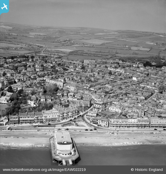
EAW022219 ENGLAND (1949). The Pavilion and the town, Sandown, from the south-east, 1949
© Copyright OpenStreetMap contributors and licensed by the OpenStreetMap Foundation. 2026. Cartography is licensed as CC BY-SA.
Nearby Images (17)
EAW022219

EPW023083

EPW023085

EPW043028

EPW039672

EAW038582

EAW038580

EPW039670

EPW023081

EAW038583

EPW039671

EPW023080

EAW022215

EPW023084

EPW043029

EAW022216

EPW043023

Details
| Title | [EAW022219] The Pavilion and the town, Sandown, from the south-east, 1949 |
| Reference | EAW022219 |
| Date | 17-April-1949 |
| Link | |
| Place name | SANDOWN |
| Parish | SANDOWN |
| District | |
| Country | ENGLAND |
| Easting / Northing | 459802, 84057 |
| Longitude / Latitude | -1.1539660681997, 50.652538978809 |
| National Grid Reference | SZ598841 |
