
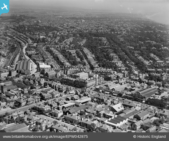
EPW042875 ENGLAND (1933). The Waverley Commercial and Family Hotel and the town, Bournemouth, from the west, 1933
© Copyright OpenStreetMap contributors and licensed by the OpenStreetMap Foundation. 2026. Cartography is licensed as CC BY-SA.
Nearby Images (19)
EPW042875

EPW042873

EPW042752

EPW042751

EPW042758

EPW042753

EPW042757

EPW042755

EPW042756

EPW042754

EPW042874

EAW033403

EPW042876

EAW033402

EAW033405

EAW033404

EAW033399

EAW033400

EAW033401

Details
| Title | [EPW042875] The Waverley Commercial and Family Hotel and the town, Bournemouth, from the west, 1933 |
| Reference | EPW042875 |
| Date | August-1933 |
| Link | |
| Place name | BOURNEMOUTH |
| Parish | |
| District | |
| Country | ENGLAND |
| Easting / Northing | 409686, 91733 |
| Longitude / Latitude | -1.8627606988003, 50.724565180248 |
| National Grid Reference | SZ097917 |
Pins

Paul Wendon |
Wednesday 17th of February 2021 10:11:22 AM | |
|
Paul Wendon |
Wednesday 17th of February 2021 10:10:34 AM | |
|
Paul Wendon |
Wednesday 17th of February 2021 10:09:00 AM |