
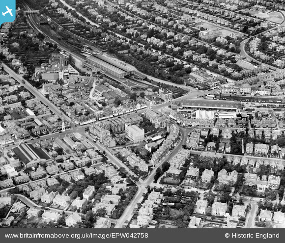
EPW042758 ENGLAND (1933). Bournemouth Station, Holdenhurst Road and the town centre, Bournemouth, 1933
© Copyright OpenStreetMap contributors and licensed by the OpenStreetMap Foundation. 2026. Cartography is licensed as CC BY-SA.
Nearby Images (20)
EPW042758

EPW042753

EPW042751

EPW042752

EPW042755

EPW042757

EPW042756

EPW042874

EPW042754

EAW033403

EPW042875

EAW033404

EAW033402

EAW033405

EAW033399

EPW042873

EAW033401

EPW042876

EAW033400

EPW046186

Details
| Title | [EPW042758] Bournemouth Station, Holdenhurst Road and the town centre, Bournemouth, 1933 |
| Reference | EPW042758 |
| Date | August-1933 |
| Link | |
| Place name | BOURNEMOUTH |
| Parish | |
| District | |
| Country | ENGLAND |
| Easting / Northing | 409816, 91801 |
| Longitude / Latitude | -1.860916945962, 50.725174567697 |
| National Grid Reference | SZ098918 |
Pins

BarryStone |
Wednesday 18th of January 2017 04:41:03 PM |