
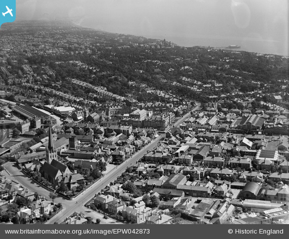
EPW042873 ENGLAND (1933). St Paul's Road and the town, Bournemouth, from the west, 1933
© Copyright OpenStreetMap contributors and licensed by the OpenStreetMap Foundation. 2026. Cartography is licensed as CC BY-SA.
Nearby Images (17)
EPW042873

EPW042875

EPW042752

EPW042751

EPW042758

EPW042753

EPW042755

EPW042757

EAW033403

EAW033402

EAW033405

EPW042756

EPW042754

EAW033404

EAW033399

EAW033400

EAW033401

Details
| Title | [EPW042873] St Paul's Road and the town, Bournemouth, from the west, 1933 |
| Reference | EPW042873 |
| Date | August-1933 |
| Link | |
| Place name | BOURNEMOUTH |
| Parish | |
| District | |
| Country | ENGLAND |
| Easting / Northing | 409649, 91778 |
| Longitude / Latitude | -1.8632837662305, 50.724970511515 |
| National Grid Reference | SZ096918 |
