
EPW042806 ENGLAND (1933). The Victoria Flour Mill, Grimsby, 1933

© Copyright OpenStreetMap contributors and licensed by the OpenStreetMap Foundation. 2026. Cartography is licensed as CC BY-SA.
Nearby Images (14)
EPW042806

EPW053401

EPW053400

EPW053402

EPW053406

EPW053403

EPW053405

EPW053399

EPW053398

EPW053404

EPW012659

EAW029028

EAW029027

EAW029026

Details
| Title | [EPW042806] The Victoria Flour Mill, Grimsby, 1933 |
| Reference | EPW042806 |
| Date | August-1933 |
| Link | |
| Place name | GRIMSBY |
| Parish | |
| District | |
| Country | ENGLAND |
| Easting / Northing | 527113, 409999 |
| Longitude / Latitude | -0.080203838201697, 53.570931824202 |
| National Grid Reference | TA271100 |
Pins

MB |
Tuesday 27th of September 2016 10:43:09 PM |
User Comment Contributions

Corporation Bridge, Grimsby, 29/08/2014 |

Class31 |
Wednesday 11th of May 2016 07:52:23 AM |
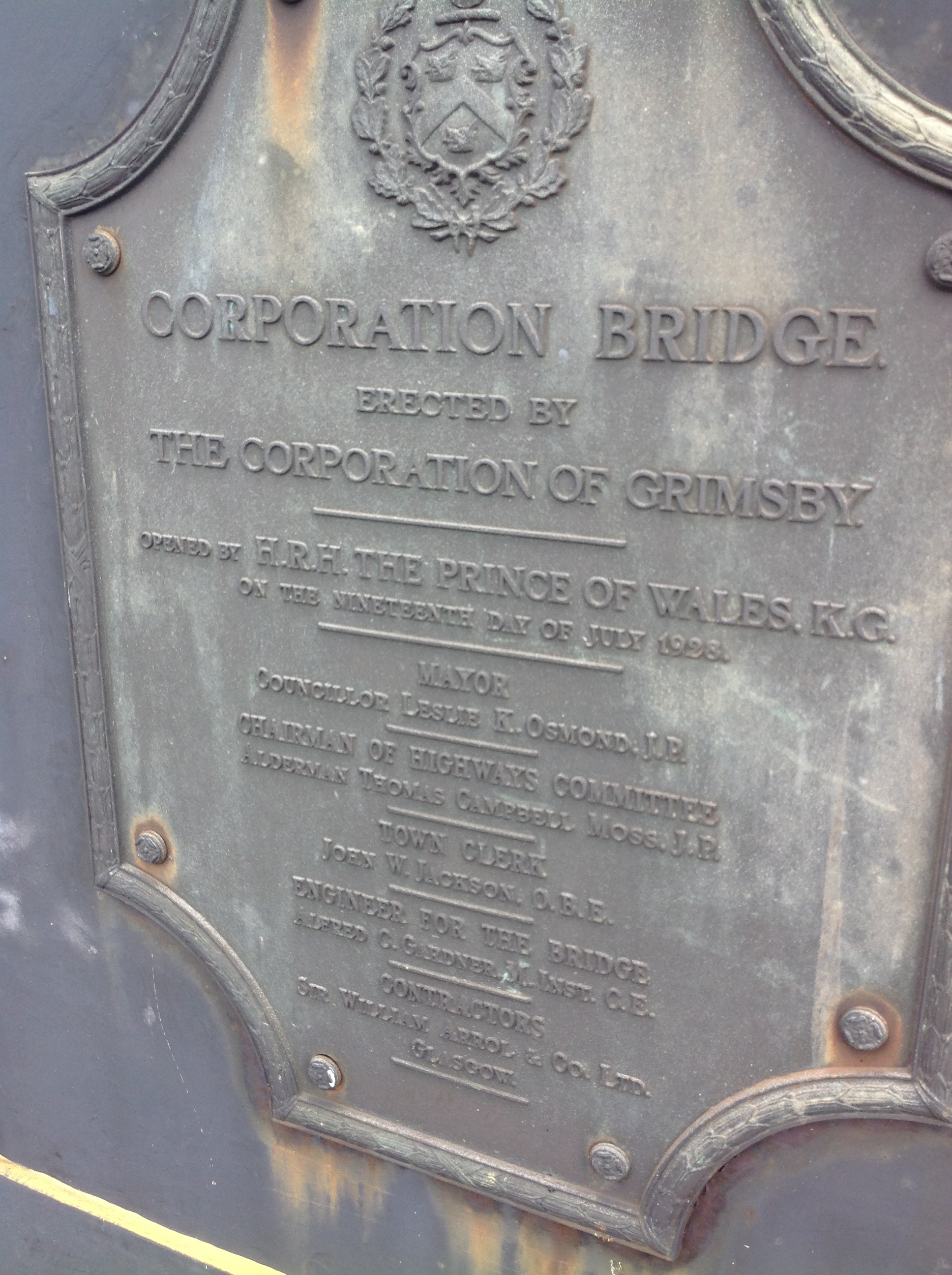
Corporation Bridge, Grimsby, 29/08/2014 |
Class31 |
Wednesday 11th of May 2016 07:51:41 AM |

Corporation Bridge, Grimsby, 29/08/2014 |
Class31 |
Wednesday 11th of May 2016 07:50:24 AM |

Corporation Bridge and Victoria Flour Mill, Grimsby, 29/08/2014 |
Class31 |
Wednesday 11th of May 2016 07:49:14 AM |
The rolling lift road bridge (Corporation Bridge) built in 1925 by Alfred C Gardner mid right |
wadey |
Monday 30th of December 2013 02:29:01 PM |