
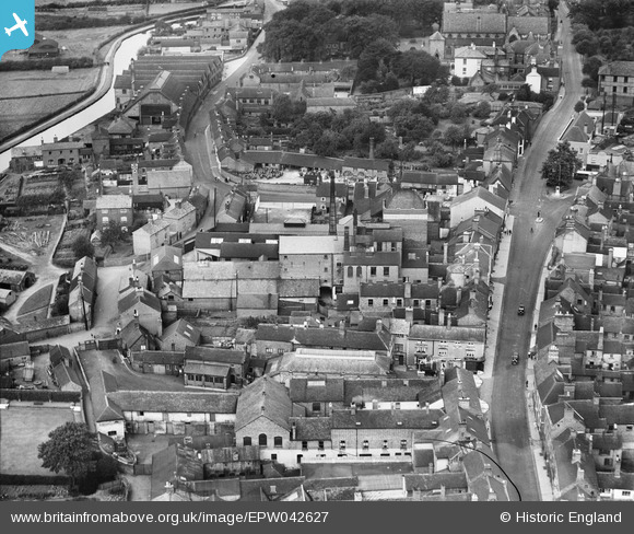
EPW042627 ENGLAND (1933). Joule's Brewery, Stone, 1933
© Copyright OpenStreetMap contributors and licensed by the OpenStreetMap Foundation. 2026. Cartography is licensed as CC BY-SA.
Nearby Images (29)
EPW042627

EPW042628

EPW042629

EPW026981

EPW026984

EPW058404

EPW058407

EPW058371

EPW047679

EPW058370

EPW026985

EPW058368

EPW053351

EPW058366

EPW020071

EPW026986

EPW058367

EPW020073

EPW058372

EPW058369

EPW058365

EPW042624

EPW042630

EPW042626

EPW042631

EPW042625

EPW042632

EPW053350

EPW026979

Details
| Title | [EPW042627] Joule's Brewery, Stone, 1933 |
| Reference | EPW042627 |
| Date | August-1933 |
| Link | |
| Place name | STONE |
| Parish | STONE |
| District | |
| Country | ENGLAND |
| Easting / Northing | 390124, 333884 |
| Longitude / Latitude | -2.1468424452103, 52.901983936551 |
| National Grid Reference | SJ901339 |
Pins
Be the first to add a comment to this image!
User Comment Contributions

John Joule & Sons Ltd. was founded in 1780 and acquired by Bass Charrington in 1968. The brewery was closed down in 1972. |

stardelta |
Tuesday 1st of July 2014 04:08:16 PM |