
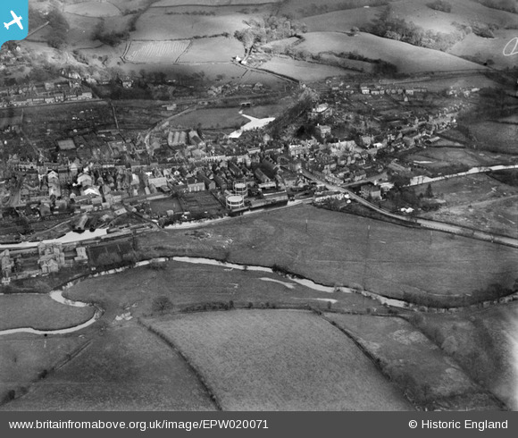
EPW020071 ENGLAND (1927). The town centre, Stone, 1927
© Copyright OpenStreetMap contributors and licensed by the OpenStreetMap Foundation. 2026. Cartography is licensed as CC BY-SA.
Nearby Images (24)
EPW020071

EPW058370

EPW058368

EPW058369

EPW058372

EPW042624

EPW058367

EPW042626

EPW042625

EPW058371

EPW026986

EPW058365

EPW058366

EPW047679

EPW058404

EPW042628

EPW042627

EPW042629

EPW053350

EPW026981

EPW058406

EPW026984

EPW026988

EPW058407

Details
| Title | [EPW020071] The town centre, Stone, 1927 |
| Reference | EPW020071 |
| Date | November-1927 |
| Link | |
| Place name | STONE |
| Parish | STONE |
| District | |
| Country | ENGLAND |
| Easting / Northing | 390189, 333723 |
| Longitude / Latitude | -2.1458711276365, 52.90053768275 |
| National Grid Reference | SJ902337 |
Pins

MB |
Wednesday 8th of January 2014 09:23:01 PM | |
|
MB |
Wednesday 8th of January 2014 09:22:14 PM | |
It once had a 22ft diameter waterwheel |
MB |
Wednesday 8th of January 2014 09:24:44 PM |
|
Ros |
Tuesday 26th of June 2012 11:08:03 AM |