
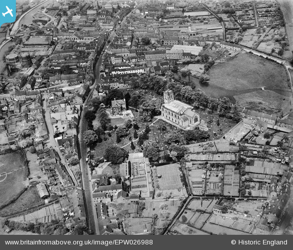
EPW026988 ENGLAND (1929). St Michael's Church and environs, Stone, 1929
© Copyright OpenStreetMap contributors and licensed by the OpenStreetMap Foundation. 2026. Cartography is licensed as CC BY-SA.
Nearby Images (19)
EPW026988

EPW058406

EPW026987

EPW053350

EPW058365

EPW058366

EPW047679

EPW026986

EPW042625

EPW058367

EPW042624

EPW042626

EPW058372

EPW058369

EPW058368

EPW058404

EPW058371

EPW058370

EPW020071

Details
| Title | [EPW026988] St Michael's Church and environs, Stone, 1929 |
| Reference | EPW026988 |
| Date | May-1929 |
| Link | |
| Place name | STONE |
| Parish | STONE |
| District | |
| Country | ENGLAND |
| Easting / Northing | 390435, 333788 |
| Longitude / Latitude | -2.1422154957741, 52.901126489508 |
| National Grid Reference | SJ904338 |
Pins
Be the first to add a comment to this image!