
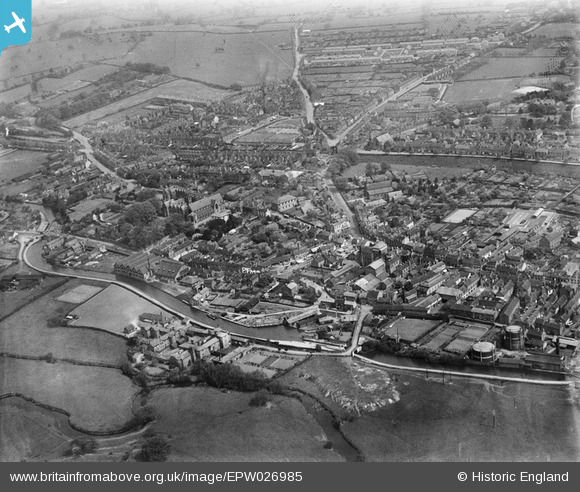
EPW026985 ENGLAND (1929). The town and surrounding countryside, Stone, 1929
© Copyright OpenStreetMap contributors and licensed by the OpenStreetMap Foundation. 2026. Cartography is licensed as CC BY-SA.
Nearby Images (19)
EPW026985

EPW053351

EPW020073

EPW058407

EPW026984

EPW042630

EPW026979

EPW026981

EPW042631

EPW042632

EPW042629

EPW042627

EPW042628

EPW026982

EPW020072

EPW058404

EPW047679

EPW058371

EPW058366

Details
| Title | [EPW026985] The town and surrounding countryside, Stone, 1929 |
| Reference | EPW026985 |
| Date | May-1929 |
| Link | |
| Place name | STONE |
| Parish | STONE |
| District | |
| Country | ENGLAND |
| Easting / Northing | 390062, 334022 |
| Longitude / Latitude | -2.1477685168735, 52.903223459816 |
| National Grid Reference | SJ901340 |
Pins
Be the first to add a comment to this image!