
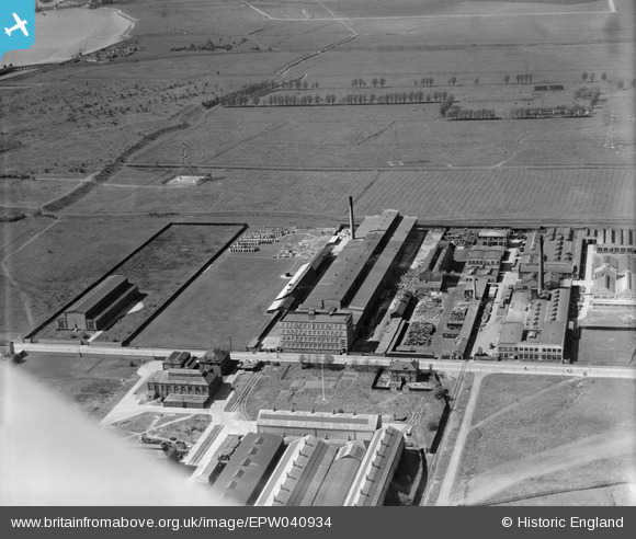
EPW040934 ENGLAND (1933). The Union Cable Co Works, the Dagenham Marshes and environs, Dagenham, 1933
© Copyright OpenStreetMap contributors and licensed by the OpenStreetMap Foundation. 2026. Cartography is licensed as CC BY-SA.
Nearby Images (32)
EPW040934

EPW040935

EPW040937

EPW040933

EPW037319

EPW040939

EPW040938

EPW040936

EPW037318

EAW031622

EAW031625

EAW031757

EAW031618

EAW031620

EAW031764

EAW031158

EAW031627

EAW031758

EAW031765

EAW031763

EAW031623

EAW031619

EAW031762

EPW005330

EAW031155

EPW051133

EPW051134

EAW031756

EAW031761

EAW052709

EPW009960

EAW031621

Details
| Title | [EPW040934] The Union Cable Co Works, the Dagenham Marshes and environs, Dagenham, 1933 |
| Reference | EPW040934 |
| Date | April-1933 |
| Link | |
| Place name | DAGENHAM |
| Parish | |
| District | |
| Country | ENGLAND |
| Easting / Northing | 548837, 182672 |
| Longitude / Latitude | 0.14562316816259, 51.522843975012 |
| National Grid Reference | TQ488827 |
Pins
Be the first to add a comment to this image!