
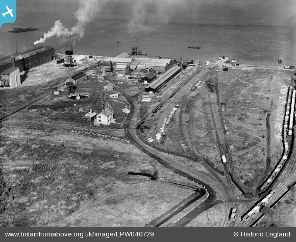
EPW040729 ENGLAND (1932). The Tower Concrete Blocks Works, Northfleet, 1932
© Copyright OpenStreetMap contributors and licensed by the OpenStreetMap Foundation. 2026. Cartography is licensed as CC BY-SA.
Nearby Images (30)
EPW040729

EPW040727

EAW050795

EAW042587

EPW028497

EAW042591

EPW028499

EAW042590

EAW042577

EAW042585

EAW042583

EAW042580

EAW042588

EPW040736

EPW028500

EPW040726

EAW042586

EAW042589

EAW042579

EAW050794

EAW042582

EPW040728

EPW040735

EAW042581

EAW042584

EAW042578

EPW017652
 at Botany Marshes, Northfleet, 1927")
EPW040733

EPW040952

EPW040730

Details
| Title | [EPW040729] The Tower Concrete Blocks Works, Northfleet, 1932 |
| Reference | EPW040729 |
| Date | October-1932 |
| Link | |
| Place name | NORTHFLEET |
| Parish | |
| District | |
| Country | ENGLAND |
| Easting / Northing | 561490, 175163 |
| Longitude / Latitude | 0.3244374476097, 51.451898377381 |
| National Grid Reference | TQ615752 |
Pins
Be the first to add a comment to this image!