
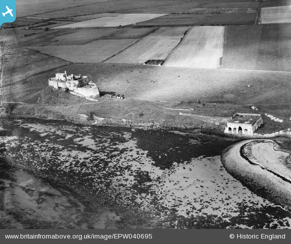
EPW040695 ENGLAND (1932). Lindisfarne Castle and the lime kilns, Holy Island, 1932
© Copyright OpenStreetMap contributors and licensed by the OpenStreetMap Foundation. 2026. Cartography is licensed as CC BY-SA.
Nearby Images (19)
EPW040695

EAW006101

EAW006100

EAW019697

EAW019696

EAW006099

EAW006098

EAW008050

EAW008898

EAW019694

EAW008899

EAW008897

EAW008900

EAW006102

EAW019695

EAW008896

EAW034341

EPW040696

EAW034340

Details
| Title | [EPW040695] Lindisfarne Castle and the lime kilns, Holy Island, 1932 |
| Reference | EPW040695 |
| Date | October-1932 |
| Link | |
| Place name | HOLY ISLAND |
| Parish | HOLY ISLAND |
| District | |
| Country | ENGLAND |
| Easting / Northing | 413725, 641719 |
| Longitude / Latitude | -1.7817756674011, 55.668790309168 |
| National Grid Reference | NU137417 |
Pins

melgibbs |
Saturday 14th of December 2013 03:53:07 PM | |

Chells809 |
Tuesday 2nd of July 2013 11:06:32 PM | |
|
Chells809 |
Tuesday 2nd of July 2013 11:04:00 PM | |
|
Chells809 |
Tuesday 2nd of July 2013 11:02:51 PM | |
|
Chells809 |
Tuesday 2nd of July 2013 11:01:49 PM |
User Comment Contributions
Looking north across the island |
Chells809 |
Tuesday 2nd of July 2013 11:08:56 PM |