
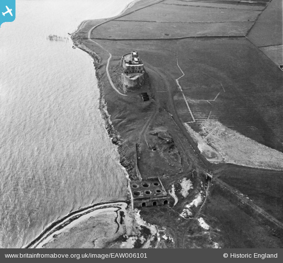
EAW006101 ENGLAND (1947). Lindisfarne Castle and adjacent lime kilns, Holy Island, 1947
© Copyright OpenStreetMap contributors and licensed by the OpenStreetMap Foundation. 2026. Cartography is licensed as CC BY-SA.
Nearby Images (19)
EAW006101

EPW040695

EAW006100

EAW006099

EAW006098

EAW019697

EAW019696

EAW006102

EAW008050

EAW008899

EAW008898

EAW019694

EAW008897

EAW008900

EAW008896

EAW019695

EPW040696

EAW034341

EAW034340

Details
| Title | [EAW006101] Lindisfarne Castle and adjacent lime kilns, Holy Island, 1947 |
| Reference | EAW006101 |
| Date | 21-May-1947 |
| Link | |
| Place name | HOLY ISLAND |
| Parish | HOLY ISLAND |
| District | |
| Country | ENGLAND |
| Easting / Northing | 413724, 641745 |
| Longitude / Latitude | -1.7817902669161, 55.669023977781 |
| National Grid Reference | NU137417 |
Pins

DaveH |
Sunday 12th of June 2016 10:25:27 PM | |
|
DaveH |
Sunday 12th of June 2016 10:21:25 PM | |

melgibbs |
Saturday 14th of December 2013 04:07:20 PM | |
|
melgibbs |
Saturday 14th of December 2013 03:56:24 PM | |
|
melgibbs |
Saturday 14th of December 2013 03:55:50 PM |