
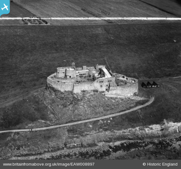
EAW008897 ENGLAND (1947). Lindisfarne Castle, Holy Island, 1947. This image has been produced from a print marked by Aerofilms Ltd for photo editing.
© Copyright OpenStreetMap contributors and licensed by the OpenStreetMap Foundation. 2026. Cartography is licensed as CC BY-SA.
Nearby Images (19)
EAW008897

EAW008900

EAW008898

EAW008896

EAW008050

EAW008899

EAW019694

EAW034341

EAW019695

EAW034340

EPW040696

EAW019696

EAW019697

EAW006100

EAW006102

EAW006098

EAW006099

EAW006101

EPW040695

Details
| Title | [EAW008897] Lindisfarne Castle, Holy Island, 1947. This image has been produced from a print marked by Aerofilms Ltd for photo editing. |
| Reference | EAW008897 |
| Date | 9-August-1947 |
| Link | |
| Place name | HOLY ISLAND |
| Parish | HOLY ISLAND |
| District | |
| Country | ENGLAND |
| Easting / Northing | 413633, 641743 |
| Longitude / Latitude | -1.7832372422304, 55.669008568741 |
| National Grid Reference | NU136417 |
