
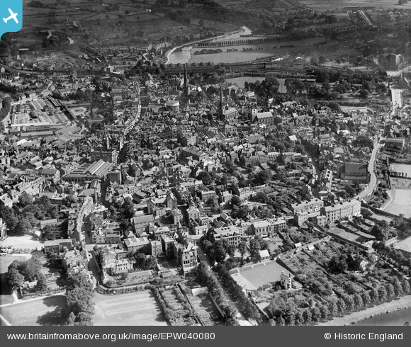
EPW040080 ENGLAND (1932). The town centre, Shrewsbury, 1932
© Copyright OpenStreetMap contributors and licensed by the OpenStreetMap Foundation. 2026. Cartography is licensed as CC BY-SA.
Nearby Images (9)
EPW040080

EPW017975

EPW040083

EPW018052

EAW012517

EAW012616

EAW001628

EAW012518

EPW018042

Details
| Title | [EPW040080] The town centre, Shrewsbury, 1932 |
| Reference | EPW040080 |
| Date | August-1932 |
| Link | |
| Place name | SHREWSBURY |
| Parish | SHREWSBURY |
| District | |
| Country | ENGLAND |
| Easting / Northing | 349081, 312364 |
| Longitude / Latitude | -2.7537077607948, 52.706203360276 |
| National Grid Reference | SJ491124 |
Pins

Andrew Bennett |
Monday 17th of June 2013 12:33:20 AM | |
During WW1, this was a major clearing centre for troops with eye injuries, treating up to 800 soldiers a week. |
Lynda Tubbs |
Tuesday 5th of August 2014 03:25:27 PM |
|
Andrew Bennett |
Monday 17th of June 2013 12:26:58 AM | |
The Shrewsbury Canal basin. Not an original part of the Shropshire Union but one of the Shropshire tub-boat canals bought by them in 1846. Not to be confused with the Shropshire Union proper, whose Shrewsbury branch was never completed south of Weston Wharf, some miles north of the town. |
gBr |
Tuesday 27th of October 2015 07:50:04 PM |
|
Andrew Bennett |
Monday 17th of June 2013 12:18:51 AM | |
|
Andrew Bennett |
Monday 17th of June 2013 12:18:27 AM | |
|
Andrew Bennett |
Monday 17th of June 2013 12:14:20 AM | |
|
Andrew Bennett |
Monday 17th of June 2013 12:13:06 AM | |
|
Andrew Bennett |
Monday 17th of June 2013 12:11:16 AM | |
|
Andrew Bennett |
Friday 7th of June 2013 12:33:11 AM | |
|
Andrew Bennett |
Friday 7th of June 2013 12:22:16 AM | |
|
Andrew Bennett |
Friday 7th of June 2013 12:21:41 AM | |
|
Andrew Bennett |
Friday 7th of June 2013 12:21:04 AM | |
|
Andrew Bennett |
Friday 7th of June 2013 12:20:12 AM | |
|
Andrew Bennett |
Friday 7th of June 2013 12:19:12 AM |
User Comment Contributions
A hospital dealing with eye injuries. |
Lynda Tubbs |
Tuesday 5th of August 2014 03:28:46 PM |