
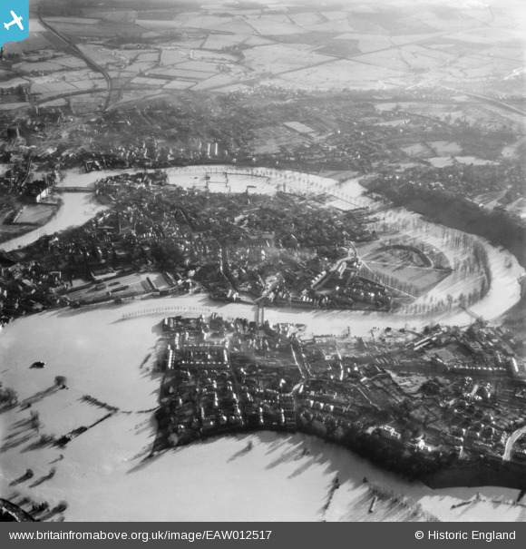
EAW012517 ENGLAND (1948). The River Severn in flood, Shrewsbury, 1948
© Copyright OpenStreetMap contributors and licensed by the OpenStreetMap Foundation. 2026. Cartography is licensed as CC BY-SA.
Nearby Images (10)
EAW012517

EPW017975

EAW001629

EPW017973

EPW017974

EPW017972

EPW040080

EPW040083

EPW018045

EPW040081

Details
| Title | [EAW012517] The River Severn in flood, Shrewsbury, 1948 |
| Reference | EAW012517 |
| Date | 14-January-1948 |
| Link | |
| Place name | SHREWSBURY |
| Parish | SHREWSBURY |
| District | |
| Country | ENGLAND |
| Easting / Northing | 348970, 312580 |
| Longitude / Latitude | -2.7553841708086, 52.708134719512 |
| National Grid Reference | SJ490126 |
Pins
Be the first to add a comment to this image!