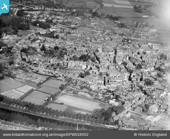
EPW018052 ENGLAND (1927). The town centre, Shrewsbury, from the south-east, 1927
© Copyright OpenStreetMap contributors and licensed by the OpenStreetMap Foundation. 2026. Cartography is licensed as CC BY-SA.
Nearby Images (6)
EPW018052

EPW018042

EPW040080

EPW040083

EPW040079

EPW018053

Details
| Title | [EPW018052] The town centre, Shrewsbury, from the south-east, 1927 |
| Reference | EPW018052 |
| Date | May-1927 |
| Link | |
| Place name | SHREWSBURY |
| Parish | SHREWSBURY |
| District | |
| Country | ENGLAND |
| Easting / Northing | 349275, 312260 |
| Longitude / Latitude | -2.7508203761558, 52.705286629321 |
| National Grid Reference | SJ493123 |
Pins

Class31 |
Monday 1st of June 2015 03:36:12 PM | |
|
Class31 |
Monday 1st of June 2015 03:19:52 PM | |
|
Class31 |
Monday 1st of June 2015 03:18:05 PM | |

Andrew Bennett |
Monday 17th of June 2013 12:52:24 AM | |
|
Andrew Bennett |
Monday 17th of June 2013 12:48:54 AM | |
|
Andrew Bennett |
Monday 17th of June 2013 12:47:03 AM | |
|
Andrew Bennett |
Monday 17th of June 2013 12:44:21 AM | |
|
Andrew Bennett |
Monday 17th of June 2013 12:42:33 AM | |
|
Andrew Bennett |
Monday 17th of June 2013 12:41:48 AM | |
|
Andrew Bennett |
Monday 17th of June 2013 12:40:29 AM | |
|
Andrew Bennett |
Monday 17th of June 2013 12:39:40 AM |