
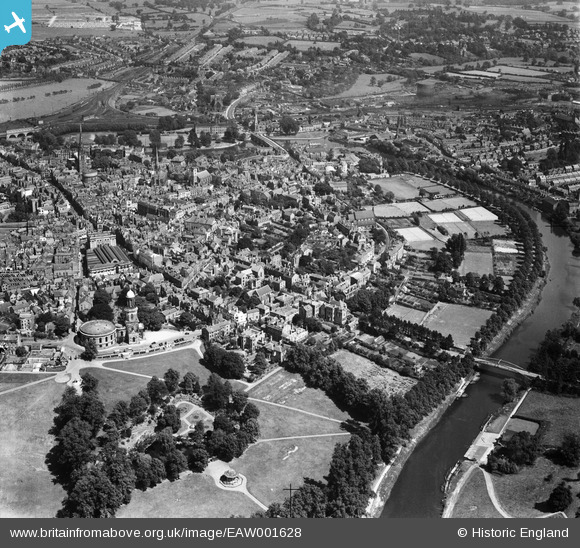
EAW001628 ENGLAND (1946). The town, Shrewsbury, from the west, 1946
© Copyright OpenStreetMap contributors and licensed by the OpenStreetMap Foundation. 2026. Cartography is licensed as CC BY-SA.
Nearby Images (7)
EAW001628

EAW012616

EPW017978

EPW018045

EPW040081

EPW017972

EPW040080

Details
| Title | [EAW001628] The town, Shrewsbury, from the west, 1946 |
| Reference | EAW001628 |
| Date | 12-July-1946 |
| Link | |
| Place name | SHREWSBURY |
| Parish | SHREWSBURY |
| District | |
| Country | ENGLAND |
| Easting / Northing | 348863, 312239 |
| Longitude / Latitude | -2.7569148663387, 52.705059070931 |
| National Grid Reference | SJ489122 |
Pins

gBr |
Tuesday 27th of October 2015 07:58:40 PM | |
|
RichardOvery |
Thursday 24th of July 2014 09:33:30 AM | |
|
H.J.Hill |
Tuesday 20th of May 2014 01:18:59 PM |
