
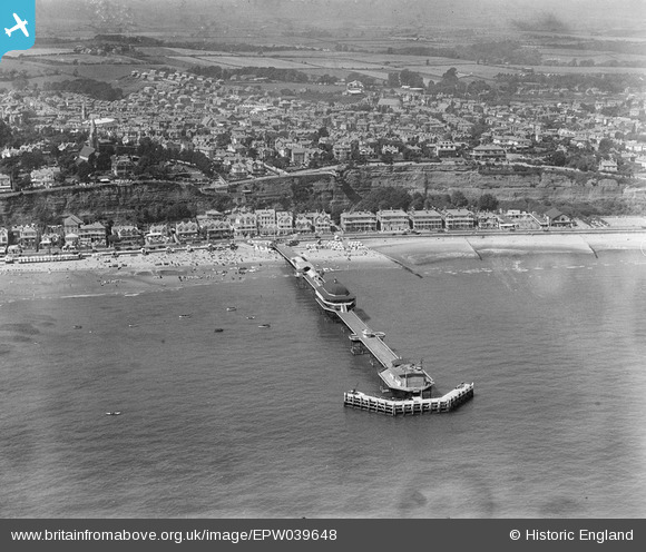
EPW039648 ENGLAND (1932). The pier and the town, Shanklin, 1932
© Copyright OpenStreetMap contributors and licensed by the OpenStreetMap Foundation. 2026. Cartography is licensed as CC BY-SA.
Nearby Images (23)
EPW039648

EPW022919

EAW028276

EPW024578

EAW022213

EPW000802

EPW043003

EAW038585

EAW022214

EPW043004

EAW015241

EAW038586

EAW022212

EPW022915

EPW022923

EPW039646

EPW022924

EAW038587

EPW022920

EPW043001

EPW043005

EAW038588

EAW028268A

Details
| Title | [EPW039648] The pier and the town, Shanklin, 1932 |
| Reference | EPW039648 |
| Date | 12-August-1932 |
| Link | |
| Place name | SHANKLIN |
| Parish | SHANKLIN |
| District | |
| Country | ENGLAND |
| Easting / Northing | 458703, 81398 |
| Longitude / Latitude | -1.1699334934359, 50.628738719036 |
| National Grid Reference | SZ587814 |
Pins
Be the first to add a comment to this image!