
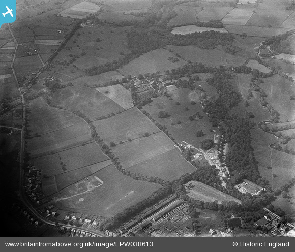
EPW038613 ENGLAND (1932). Pownall Hall and new housing under construction at the edge of Carr Wood, Pownall Park, 1932
© Copyright OpenStreetMap contributors and licensed by the OpenStreetMap Foundation. 2025. Cartography is licensed as CC BY-SA.
Nearby Images (6)
EPW038613

EPW038610

EPW038611

EPW038609

EPW038607

EPW038608

Details
| Title | [EPW038613] Pownall Hall and new housing under construction at the edge of Carr Wood, Pownall Park, 1932 |
| Reference | EPW038613 |
| Date | June-1932 |
| Link | |
| Place name | POWNALL PARK |
| Parish | |
| District | |
| Country | ENGLAND |
| Easting / Northing | 383735, 381674 |
| Longitude / Latitude | -2.2442602517919, 53.33145872906 |
| National Grid Reference | SJ837817 |
Pins
Be the first to add a comment to this image!