
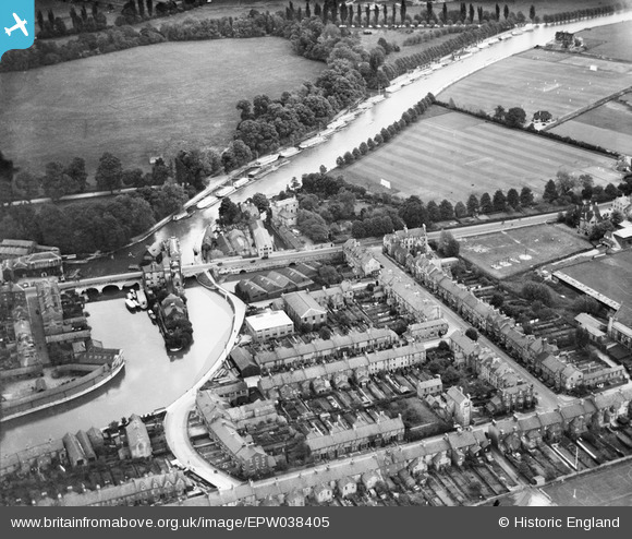
EPW038405 ENGLAND (1932). Folly Bridge and environs, Oxford, 1932
© Copyright OpenStreetMap contributors and licensed by the OpenStreetMap Foundation. 2026. Cartography is licensed as CC BY-SA.
Nearby Images (9)
EPW038405

EAW047926

EPW038407

EPW000836

EPW000824

EPW038404

EAW014894

EAW003602

EPW000821

Details
| Title | [EPW038405] Folly Bridge and environs, Oxford, 1932 |
| Reference | EPW038405 |
| Date | June-1932 |
| Link | |
| Place name | OXFORD |
| Parish | |
| District | |
| Country | ENGLAND |
| Easting / Northing | 451442, 205442 |
| Longitude / Latitude | -1.2548208074776, 51.744858985209 |
| National Grid Reference | SP514054 |
