
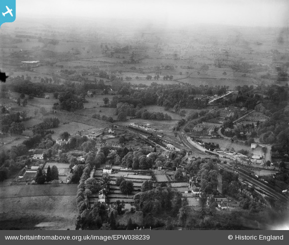
EPW038239 ENGLAND (1932). The area around Sevenoaks Railway Station and construction of new housing at Bosville Drive, Sevenoaks, from the south-west, 1932
© Copyright OpenStreetMap contributors and licensed by the OpenStreetMap Foundation. 2025. Cartography is licensed as CC BY-SA.
Nearby Images (5)
EPW038239

EPW038237

EPW038242

EPW001428

EPW038240

Details
| Title | [EPW038239] The area around Sevenoaks Railway Station and construction of new housing at Bosville Drive, Sevenoaks, from the south-west, 1932 |
| Reference | EPW038239 |
| Date | June-1932 |
| Link | |
| Place name | SEVENOAKS |
| Parish | SEVENOAKS |
| District | |
| Country | ENGLAND |
| Easting / Northing | 552075, 155300 |
| Longitude / Latitude | 0.18053314963904, 51.276013500759 |
| National Grid Reference | TQ521553 |
Pins
Be the first to add a comment to this image!