
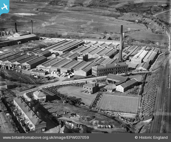
EPW037059 ENGLAND (1931). The Chloride Electrical Storage Works, Clifton Junction, 1931
© Copyright OpenStreetMap contributors and licensed by the OpenStreetMap Foundation. 2026. Cartography is licensed as CC BY-SA.
Nearby Images (29)
EPW037059

EPW037058

EPW037062

EPW044420

EPW044416

EPW044414

EPW037065

EPW037064

EPW037061

EPW044415

EPW037060

EPW037063

EPW045102

EPW037066

EPW045104

EPW044419

EPW045100

EPW045106

EPW045101

EPW013132

EPW045105

EPW044418

EPW045103

EPW044417

EPW044412

EPW044413

EPW057311

EPW057309

EPW057310

Details
| Title | [EPW037059] The Chloride Electrical Storage Works, Clifton Junction, 1931 |
| Reference | EPW037059 |
| Date | October-1931 |
| Link | |
| Place name | CLIFTON JUNCTION |
| Parish | |
| District | |
| Country | ENGLAND |
| Easting / Northing | 379179, 403201 |
| Longitude / Latitude | -2.3141024750697, 53.524814642473 |
| National Grid Reference | SD792032 |
Pins

Pablo |
Wednesday 9th of October 2024 03:42:23 PM | |
|
Paul Williams |
Monday 28th of December 2020 04:29:31 PM | |

Maurice |
Monday 29th of September 2014 06:39:00 AM | |
|
Maurice |
Monday 29th of September 2014 06:37:40 AM | |
|
Maurice |
Monday 29th of September 2014 06:35:34 AM |