
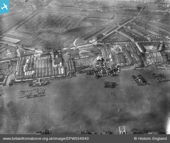
EPW034940 ENGLAND (1931). The Morton's Jam Factory and environs, Cubitt Town, 1931
© Copyright OpenStreetMap contributors and licensed by the OpenStreetMap Foundation. 2026. Cartography is licensed as CC BY-SA.
Nearby Images (19)
EPW034940

EPW034941

EPW034943

EPW034939

EPW034938

EPW034937

EPW034944

EPW034936

EPW034942

EPW026718

EPW026716

EPW026712

EPW026713

EPW026715

EPW026711

EPW026710

EPW026717

EPW026714

EPW026709

Details
| Title | [EPW034940] The Morton's Jam Factory and environs, Cubitt Town, 1931 |
| Reference | EPW034940 |
| Date | 10-April-1931 |
| Link | |
| Place name | CUBITT TOWN |
| Parish | |
| District | |
| Country | ENGLAND |
| Easting / Northing | 538526, 179218 |
| Longitude / Latitude | -0.0042759449179336, 51.494426437058 |
| National Grid Reference | TQ385792 |
